10.6 sec in total
28 ms
5.5 sec
5.1 sec
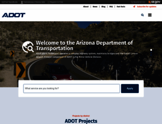
Welcome to azdot.gov homepage info - get ready to check Azdot best content for United States right away, or after learning these important things about azdot.gov
Visit azdot.govWe analyzed Azdot.gov page load time and found that the first response time was 28 ms and then it took 10.6 sec to load all DOM resources and completely render a web page. This is a poor result, as 90% of websites can load faster.
azdot.gov performance score
name
value
score
weighting
Value6.4 s
2/100
10%
Value69.0 s
0/100
25%
Value26.6 s
0/100
10%
Value6,130 ms
0/100
30%
Value0.099
90/100
15%
Value72.0 s
0/100
10%
28 ms
46 ms
46 ms
125 ms
59 ms
Our browser made a total of 231 requests to load all elements on the main page. We found that 83% of them (191 requests) were addressed to the original Azdot.gov, 4% (9 requests) were made to Fonts.gstatic.com and 3% (6 requests) were made to Static.az.gov. The less responsive or slowest element that took the longest time to load (4.1 sec) belongs to the original domain Azdot.gov.
Page size can be reduced by 3.5 MB (10%)
36.8 MB
33.3 MB
In fact, the total size of Azdot.gov main page is 36.8 MB. This result falls beyond the top 1M of websites and identifies a large and not optimized web page that may take ages to load. Only a small number of websites need less resources to load. Images take 35.8 MB which makes up the majority of the site volume.
Potential reduce by 331.3 kB
HTML content can be minified and compressed by a website’s server. The most efficient way is to compress content using GZIP which reduces data amount travelling through the network between server and browser. HTML code on this page is well minified. It is highly recommended that content of this web page should be compressed using GZIP, as it can save up to 331.3 kB or 85% of the original size.
Potential reduce by 2.7 MB
Image size optimization can help to speed up a website loading time. The chart above shows the difference between the size before and after optimization. Azdot images are well optimized though.
Potential reduce by 21.5 kB
It’s better to minify JavaScript in order to improve website performance. The diagram shows the current total size of all JavaScript files against the prospective JavaScript size after its minification and compression. It is highly recommended that all JavaScript files should be compressed and minified as it can save up to 21.5 kB or 12% of the original size.
Potential reduce by 424.7 kB
CSS files minification is very important to reduce a web page rendering time. The faster CSS files can load, the earlier a page can be rendered. Azdot.gov needs all CSS files to be minified and compressed as it can save up to 424.7 kB or 94% of the original size.
Number of requests can be reduced by 33 (15%)
215
182
The browser has sent 215 CSS, Javascripts, AJAX and image requests in order to completely render the main page of Azdot. We recommend that multiple CSS and JavaScript files should be merged into one by each type, as it can help reduce assets requests from 20 to 1 for JavaScripts and from 15 to 1 for CSS and as a result speed up the page load time.
azdot.gov
28 ms
azdot.gov
46 ms
home
46 ms
js
125 ms
google_tag.script.js
59 ms
css_MxoX9yVG2f-uJ3OogPy5Cqd-PWAXBr-v2bBEky9r7ew.css
84 ms
all.min.css
310 ms
css_FVKlKJ82QEGKKsVzRAwwk2Kc5LqpWzvtjUcJEL1pwzA.css
85 ms
aos.css
305 ms
css_inE5CWFwpf1C5yLbQtpmUSJNx-3k3WDdtwGhbJNceuM.css
83 ms
css_fCX5cekqCeGrovGVE0DCrONte5t9u5CdP5f-ivPZkqY.css
87 ms
font-awesome.min.css
112 ms
all.css
305 ms
icon
305 ms
css_G3qs1p6T1JucFZLjLU3haF2JrMU1DaJNPfH_iH4OvH8.css
87 ms
css2
499 ms
css_9qdyTETlj0TRmR3N3Rtjon3CfbxhxPa-Dm37ih3SO-Y.css
160 ms
slick.css
103 ms
css_VkgbFZkOqI9QcF3QkSR_z6kHLfoQdz4ag-9AiQWSctA.css
376 ms
js_rDsgV8UhA4osPa-2hr9toIakouU0__AhF9Kaloo9alg.js
294 ms
element.js
491 ms
js_ioXW7H6BKN-Bsae_qBuEQW5c9fgAfCZqwabg99bLsQg.js
367 ms
aos.js
483 ms
js_sJiTqweUBgXZMh-rcoTUZtexjV7S1XEH7CWhFeXkJaA.js
285 ms
monsido-script.js
486 ms
js_HDw8_W-r6JM7z69qUVMj58mD3weGpM28Fmswp6Ds5Ts.js
300 ms
popper.min.js
293 ms
bootstrap.min.js
486 ms
js_4_yfbKtPaAbT1BwX7sQRlMLUD_FOCI6LUHE3rqwOgPU.js
485 ms
slick.min.js
486 ms
js_3VdHRh9vlcN_LKj4dmHhIEf9nzEWTftwXDR2x1EgIBQ.js
484 ms
ADOT_Logo_blue.webp
952 ms
SR88%20Improvements-Drone2_110118_17.jpg
1248 ms
Vector%20%281%29_1.png
951 ms
DJI_0008.jpg
1246 ms
Vector%20%281%29_2.png
951 ms
Drone%2051938677013_a35f6a38c1_o.jpg
1246 ms
Vector%20%281%29_3.png
1243 ms
I10-Wild-Horse-Pass-Logo_600w.png
1243 ms
logo-adot-broadway-curve-600x.jpg
1243 ms
logo-i17-project-padded-512x.jpg
1522 ms
Paving-photo-for-website.jpg
1522 ms
Orange%201_020119%20.jpg
1520 ms
Map-Grand-Canyon-National-Park-Airport-Runway-Rehabilitation-Project.jpg
1522 ms
Map-US-60-Wenden-bridge-replacement.jpg
1523 ms
map-higley-and-germann-gilbert-improvement-project.jpg
1522 ms
Map-Rittenhouse-Rd-Ocotillo-Rd.jpg
1885 ms
us-map-191-sr-266-to-sr-366-pavement-preservation.jpg
1885 ms
loop-101-price-freeway-pavement-improvements-map.jpg
1887 ms
map-us95-castle-dome-project.jpg
1887 ms
Ash-Creek-Bridges-map_01.jpg
1885 ms
Map-I-40-South-of-Ash-Fork.jpg
1885 ms
map-us-93-cane-springs-improvement-project.jpg
3647 ms
map-interstate-10-and-loop-101-system-interchange.jpg
3644 ms
Map-SR377-SR-277.jpg
3645 ms
Map-US-89-Timberline-Trail-to-Deadman-Flat-Rd.jpg
3644 ms
Map-I-40-Dead-River-Bridge-rehabilitation.jpg
3645 ms
Map-US-160-and-IR-21-Intersection-Improvements.jpg
3644 ms
Map-Mountain-View-Road-Improvement.jpg
3673 ms
map-SR-87-Coyote-Wash-Bridge.jpg
3665 ms
US60-Vicksburg-RoadtoSR-Junction-Map.jpg
3669 ms
Map-I-17-Airport-Road.jpg
3670 ms
NW-District-Project-Map-I-40-Fort-Rock-Rd-to-Markham-Wash-Paving.jpg
4042 ms
Naranja-Path-Project-Map.jpg
3672 ms
SR85-milepost-0-to-16-01-01.jpg
4072 ms
i10-sr87-i8-pavement-pres-map.jpg
4074 ms
SR347-corridor-widening-intersections-map.jpg
4079 ms
va9B4kDNxMZdWfMOD5VnZKvuQQ.ttf
675 ms
va9E4kDNxMZdWfMOD5VfkA.ttf
995 ms
va9B4kDNxMZdWfMOD5VnPKruQQ.ttf
996 ms
va9B4kDNxMZdWfMOD5VnWKnuQQ.ttf
999 ms
va9C4kDNxMZdWfMOD5Vn9IjO.ttf
1306 ms
va9B4kDNxMZdWfMOD5VnSKzuQQ.ttf
999 ms
va9B4kDNxMZdWfMOD5VnLK3uQQ.ttf
1306 ms
va9B4kDNxMZdWfMOD5VnMK7uQQ.ttf
1313 ms
va9B4kDNxMZdWfMOD5VnFK_uQQ.ttf
1313 ms
fontawesome-webfont.woff
370 ms
gtm.js
811 ms
Map-I-103rd-Ave-Pump-project.jpg
3132 ms
Map-SR-87-MP-135-and-SR-287-MP-135.jpg
3134 ms
Map-US-93-Legend-Ranch-Road-to-Date-Creek-Road-prf3.jpg
2842 ms
SR-187-SR-387-to-SR-87-Project-map.jpg
2861 ms
us191-10-bridge-repair-map.jpg
2845 ms
interstate-10-kino-to-country-club-interstate-photo.jpg
2843 ms
map-us-93-pavement-project-gunsite-canyon-road-to-gray-wash.jpg
2843 ms
US-160-SR-98-map.jpg
2842 ms
nw-District-New-Project-Map-for-US-93-Sycamore-Creek.jpg
2842 ms
fa-brands-400.woff
635 ms
fa-brands-400.woff
634 ms
book-icon.png
2400 ms
sliver.css
2429 ms
ombudsman-icon.png
2567 ms
vote-icon.png
2567 ms
icon-searchlink.png
2566 ms
logo-small.png
2567 ms
Map-Grand-Ave-57-Dr.jpg
2570 ms
828338-map-SR-90-Pavement-Rehab-Border-Patrol-Station-to-Moson-Rd.jpg
2572 ms
FINAL_Map-SR-347-projects-update_rev.jpg
2569 ms
828332-map-sr-10-b-and-sr-186-01-01.jpg
2569 ms
21-217-map-sr-260-lion-sps.jpg
2570 ms
20230817_I-10%20Germann%20Rd_Project%20Map_v1.png
2573 ms
js
2475 ms
web-vitals.iife.js
2047 ms
Map-SR-347-widening-SR-238-to-City-of-Maricopa.jpg
2209 ms
810259-Map-I-10-Dome-Rock-Rd.jpg
2207 ms
sr-89a-pavement-preservation-cottonwood-map.jpg
2208 ms
I-10-Truck-Parking-Availability-System-Map.jpg
2210 ms
798110-US-89-Wash-Moenkopi-Wash-and-Five-Mile-Wash-Bridges-Map.jpg
2211 ms
US60-Loop-303-map.jpg
2212 ms
796050-Map-I-40-Walnut-Creek-to-Holy-Moses-Wash-Pavement-Preservation.jpg
451 ms
Map-SR87-SR260_SR179.jpg
453 ms
guard-rail.jpg
453 ms
86.EB_.VIEW_.2.jpg
457 ms
gca-runway-02.jpg
455 ms
Grand-Canyon-Airport.jpg
455 ms
web-vitals.iife.js
10 ms
gca-runway-01.jpg
434 ms
Grand-Canyon-Airport-ARFF-vehicle.jpg
432 ms
terminal-remodel-01.png
433 ms
sr95-courtwright-rd-bullhead-city-pkwy-map.jpg
431 ms
51-at-CamelbackRd-map.jpg
65 ms
map-sr-95-sara-park-to-i-40_0.jpg
136 ms
us-89-a-fredonia-map.jpg
133 ms
map-sr169-i17-bridge-project.jpg
131 ms
new-antares-road-bridge-over-truxton-wash-map.jpg
131 ms
us-93-vista-royale-widening-map.png
131 ms
795060-mapI-40-joseph-cityperkins-valleyProject-365x310.jpg
129 ms
map-i40-joseph-city-perkins-valley-project.jpg
131 ms
i-8-pavement-preservation-milepost-71-82-map.jpg
132 ms
I-8-milepost-135-to-pinal-county-line-pavement-preservation-map.jpg
128 ms
Map-I-40-East-Kingman-Andy-Devine-Ave-Bridge-Rehabilitation.jpg
133 ms
i-40-topock-needle-mountain-road-pavement-preservation-pavement-photo.jpg
131 ms
SR264-Tuba-City.jpg
128 ms
map-sr69-Truwood-Stoneridge_0.jpg
131 ms
map-cornville-road-improvements_0.jpg
128 ms
map-us-93-nothing-sr-97_0.jpg
131 ms
us-93-tegner-street-wickenburg-ranch-way-map.jpg
132 ms
sr-87-teesto-wash-bridge-map.jpg
129 ms
i-40-willow-bridge-replacement-construction-photo.jpg
132 ms
i-10-pavement-rehab-map.jpg
130 ms
i-10-wintersburg-pavement-preservation-map_0.jpg
132 ms
W-I40-sign.jpg
132 ms
sr-88-tomahawk-to-buffalo-drainage-improvements-map-365x310_0.jpg
129 ms
SR88-traffic-sign-project-photo.jpg
132 ms
780282-Map-SR-80-Bridge-prf1.jpg
132 ms
sr-264--ir4-intersection-map.jpg
129 ms
i-40-perkins-valley-to-holbrook-map.jpg
130 ms
sr-287-roundabout-exhibit-map.png
132 ms
22-048-coolidge-florence-map.jpg
130 ms
21-015-SR79-Gila-River-bridge.jpg
131 ms
20-361-Map-SR-77-Junction-1-10-to-Calle-Concordia-project-365x310.jpg
137 ms
us-191-chinle-lukachukai-wash-bridges-project-image-05.jpg
135 ms
us-191-chinle-lukachukai-wash-bridges-project-image-04_0%20%281%29.jpg
138 ms
US-19-Chinle-Black-Mountain-map.jpg
138 ms
US-60-and-SR-260-map_0_0.jpg
138 ms
us-60-north-fork-rd-sr-61-map.jpg
138 ms
I-10Gap-MAP2.JPG
46 ms
Paving_SR24.jpg
44 ms
Map-US-95-Widening-Phase-2.jpg
57 ms
SR260.view_.climbing.jpg
40 ms
sr-377-map.jpg
44 ms
21-337-Map-Interstate-8-Sentinel-Rest-Area-Rehabilitation-prf2.jpg
39 ms
sr-264-mp-465-new-mexico-state-line.jpg
69 ms
SR-264-moenkopi-rehabilitation-map.jpg
46 ms
SR260_Hondah.jpg
55 ms
sr-89-yarnell-map.jpg
52 ms
us-60-centennial-aguila-pavement-preservation-map_0.JPG
70 ms
sr-260-project-map.jpg
84 ms
Map-US-60-L101-to-L202-Pavement-Preservation.jpg
94 ms
SR89A_map-OakCreekCanyon.jpg
71 ms
I-17-SB-Coconino-County-Line-Map.jpg
74 ms
map-us60-sossaman-to-meridian-corridor.jpg
85 ms
sr-347-old-maricopa-project-map.jpg
87 ms
US93-Moore-Ranch-Rd-Improvement-Project-map.jpg
94 ms
SR24-Ellsworth-Ironwood.jpg
94 ms
us-93-kabba-bridge-photo.jpg
118 ms
us-93-installation-of-rumble-strips-map.jpg
121 ms
21-179-map-US93-Summer-2023-FINAL.jpg
113 ms
sr-95-needles-bridge-photo.jpg
122 ms
sr-89a-pavement-preservation-map.jpg
103 ms
sr-89a-prescott-valley-map.jpg
130 ms
20-127-Map-SR-69-Prescott-Lake-update-prf1.jpg
126 ms
SR303-LLP.jpg
128 ms
SR303-Lake-Pleasant.jpg
149 ms
I-10%20and%20SMF_2.jpg
157 ms
sr69-big-bug-poland-map.jpg
137 ms
sr-68-pavement-preservatin-project-map.jpg
166 ms
21-301-I40-Rancho-Santa-FeTI-Map.JPG
164 ms
Seligman%2066.png
141 ms
I-40-anvil-rock-road-project-map.jpg
158 ms
Sunset%20Point%20Rest%20Area.jpg
185 ms
S.%20Mnt.%20Freeway%20art.jpg
159 ms
101-Pima_0.jpg
181 ms
Loop-101-%28Agua-Fria-Freeway%29%2C-75th-Avenue-to-I-17-Improvements.jpg
168 ms
16th-st-wall-photo-west.jpg
171 ms
21-001-lindsay-interchange-project-map.JPG
177 ms
SR-80-Mule-Pass-Tunnel-Safety-Project-Bisbee.jpg
169 ms
810818-B-8-Weidner-St-to-Old-Hwy-80-map.jpg
182 ms
I15-Virgin-River-Bridge1-map.JPG
182 ms
I-17-Van-Buren-to-Anthem-Way.jpg
174 ms
I-17-Dunlap-Avenue-to-Deer-Valley-Road.jpg
177 ms
Graphic-of-proposed-3-level-TI.jpg
166 ms
Map-ITS-McGuirevill-Rest-Area-to-Anthem-Way.jpg
156 ms
Interstate-17-%28Black-Canyon-Freeway%29-Auxiliary-Lane-Improvements.jpg
178 ms
I-17-Frontage-Road-Drainage-Improvement.jpg
174 ms
Mill%20and%20Fill%203.png
184 ms
I-10_verrado_0.jpg
159 ms
how-diamond-grinding-works.jpg
160 ms
paving.jpg
176 ms
us-60-bridges-waterfall-canyon-photo.jpg
171 ms
ADOT-News-Icon_0.jpg
193 ms
WeekendFreewayMapADOTmay0224J2.jpg
159 ms
IMG_6499.JPG
151 ms
34909991765_9d50e03368_k.png
168 ms
_MG_0006.png
164 ms
IMG_0018%20%281%29.png
166 ms
Group%20639.png
146 ms
icon-adot-mobile-app-64x%20%281%29_0.png
161 ms
digital-ids-01.png
190 ms
icon-i10-broadway-curve-app.png
246 ms
icon-adot-virgin-river-bridge-app.png
171 ms
Footer-Seal_11.svg
136 ms
SR88%20Improvements-Drone2_110118_17.jpg
222 ms
DJI_0008.jpg
195 ms
Drone%2051938677013_a35f6a38c1_o.jpg
241 ms
Traveller-map-overlay.png
171 ms
bg-art.png
143 ms
tracking.monsido.com
65 ms
heatmaps.js
56 ms
mon-page-assist-loader.js
30 ms
page-correct.js
72 ms
azdot.gov accessibility score
Contrast
These are opportunities to improve the legibility of your content.
Impact
Issue
Background and foreground colors do not have a sufficient contrast ratio.
Names and labels
These are opportunities to improve the semantics of the controls in your application. This may enhance the experience for users of assistive technology, like a screen reader.
Impact
Issue
Links do not have a discernible name
azdot.gov best practices score
Trust and Safety
Impact
Issue
Does not use HTTPS
Ensure CSP is effective against XSS attacks
User Experience
Impact
Issue
Serves images with low resolution
General
Impact
Issue
Detected JavaScript libraries
Browser errors were logged to the console
Page has valid source maps
azdot.gov SEO score
Content Best Practices
Format your HTML in a way that enables crawlers to better understand your app’s content.
Impact
Issue
Links do not have descriptive text
Crawling and Indexing
To appear in search results, crawlers need access to your app.
Impact
Issue
Links are not crawlable
Mobile Friendly
Make sure your pages are mobile friendly so users don’t have to pinch or zoom in order to read the content pages. [Learn more](https://developers.google.com/search/mobile-sites/).
Impact
Issue
Document uses legible font sizes
Tap targets are not sized appropriately
EN
EN
UTF-8
Language claimed in HTML meta tag should match the language actually used on the web page. Otherwise Azdot.gov can be misinterpreted by Google and other search engines. Our service has detected that English is used on the page, and it matches the claimed language. Our system also found out that Azdot.gov main page’s claimed encoding is utf-8. Use of this encoding format is the best practice as the main page visitors from all over the world won’t have any issues with symbol transcription.
azdot.gov
Open Graph description is not detected on the main page of Azdot. Lack of Open Graph description can be counter-productive for their social media presence, as such a description allows converting a website homepage (or other pages) into good-looking, rich and well-structured posts, when it is being shared on Facebook and other social media. For example, adding the following code snippet into HTML <head> tag will help to represent this web page correctly in social networks: